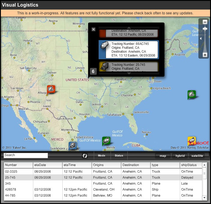
This was a really cool application using several mapping apps and an Actionscript layer to dynamically display where a customer’s shipment would be at all times. The unique factor is that the customer would be able to drill down into the shipment to confirm information to avoid any confusion between manufacturers. Shipments could be tracked via RFID or vehicle GPS coordinates.
The original was programmed using both Google Maps and Yahoo Maps. At the time Yahoo Maps had the more robust Actionscript overlay.
Currently the dummy version I had usually posted no longer works. Google Maps have updated all their APIs and my scripting is now out-dated.